Entries Tagged as 'Travel'

“All we know is it’s dark down there.”
HALFACAT, Indiana —Local officials remain stumped by a pothole with no apparent bottom on Ferndog Pike, near the intersection with Poady Road. According to Rusty Midfoster, Street Maintenance Supervisor for the city, “We get a lot of potholes here, but most of them are small and hold water, but this one I don’t know. We dropped a cone in it and didn’t hear a splash. Or anything.” At press time, the city’s Special Projects Coordinator and Director of Street Operations were preparing to publish a new QR code to replace the one that replaced the pothole tip line that was replaced by an email address in 2022. It should appear soon at halfacat.in.gov/you-report, where non-emergency forms can be filled out.
Tags: Roads/Bridges · Rural · Traffic & Parking · Travel

A parking meter in Wheeling, West Virginia.
On our drive back to Indiana from New York last week, we stopped for dinner in Wheeling, West Virginia. This was the meter for the space where I parked across from Elle & Jack’s (which I recommend). It’s an old-fashioned mechanical meter, with slots for nickels, dimes, and quarters. All three were plugged. We took an outside table across from the space, where I asked the waitress what the parking hours were. “With all the construction downtown, it doesn’t matter,” she said. “You’re fine.” I suppose that meant the city wasn’t big on enforcement at the time.
But I was prepared to pay because I have a ParkMobile app, which I use here in Bloomington. With some experience at using the app, I’d like to make a couple of points about the shift of parking payment infrastructures from old to new.
First, it’s interesting that this parking meter is now just a sign for ParkMobile. The legacy design pattern had me fooled when I parked because it seemed to welcome coins before I discovered the slots were plugged. Also, the parking meters in Bloomington are a newer kind that are both mechanical and electronic: they accept quarters, while also displaying the ParkMobile zone. Since paying with coins costs less than using the ParkMobile app, we keep a cache of quarters in a little dashboard compartment for that purpose in our new used car (a 2017 VW Golf Alltrack, which I also recommend). But Wheeling made a good cost-saving choice by leaving the meters in place and putting a ParkMobile sign on them.
Second is that ParkMobile still has room to improve. A few weeks ago, I got a parking ticket during the two hours I bought from ParkMobile using the app. When I went to the city parking office to dispute the ticket, they told me the ticket was for my old New York license plate, which was still active on the app, but not the one I selected, which was for the current Indiana plate. ParkMobile should make it easier to delete an old plate and fix whatever went wrong after I selected the right one. I believe this is not an uncommon occurrence, because a conversation I half-overheard at the parking office suggested as much.
I have more thoughts about the transition of parking payment from legacy systems to apps on phones, but I’ll save those until I know more about the topic than I do now.
Tags: Standards · Traffic & Parking · Travel
If you want an idea of how key to Baltimore the Francis Scott Key Bridge is, here are some photos to remind you:

Baltimore Harbor. Note the Francis Scott Key Bridge, above the middle.

On the right is the Francis Scott Key Bridge, also known in its time as the Car Strangled Spanner. It was dropped by the MV Dali container ship. Note that these ships all load and unload on the far side of the bridge at many docking sites. All need to thread the eye of the bridge’s needle.

This view shows the whole span of the bridge, from the north side to the south, across the mouth of the harbor.
Those three are among six I’ve posted on Flickr for the sole purpose of making them useful. Such as now, twelve years after I shot them. Because yesterday an errant cargo ship, the MV Dali, brought the bridge down by taking out the southwest support column (left side in this view) for the central span, killing at least six people and leaving the “Car Strangled Spanner” out of commission for the next few years.
Like all my other public photos, these are Creative Commons licensed to require only attribution. I see this as the infrastructure of public photography supporting the infrastructures of journalism and archivy.*
Photographically, they aren’t great. But they are free, so if you’re writing about the bridge and want an easy photo to use, have at ’em.
*Meaning (if you skip that link) “the discipline of archives.” For the practice of creating and maintaining archives, I prefer archivery, and would have used it here if a search for that word hadn’t suggested archivy instead.
Tags: Building · Emergency · Geography · Industry · Media · Photography · Roads/Bridges · Travel · Water
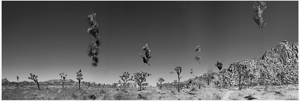
Joshua trees shot in pano mode by a phone in a moving car.
I’m making lemonade here. The lemon is erroneously putting an album of photos shot at Joshua Tree National Park into my Flickr site devoted to infrastructure rather than the one for everything else. The lemonade is giving this blog some juice in the form of a useful topic: absence of infrastructure. There is a lot of that in the world, and this park is an okay example.
I say okay because it’s not Antarctica, the middle of the ocean, or the Taklamakan. There is a paved road, on which tantalized visitors can gaze through car windows before they hike off on foot to look at wildlife, climb rocks, and enjoy other adventures. There is also some cell coverage, even though the park says there is none. We could get online most of the way to the Wall Street Stamp Mill ruins. Two days earlier we took a hike to Barker Dam, which also featured a bit of cell coverage.
Just off the trail nearby are the remains of a windpump style windmill, that supplied water for the mill and the ranches nearby. Not sure what anyone ranched there, but the windpump made a degree of civilization possible. And I suppose that’s what infrastructure is: a minimum requirement for the kind of life we call civilized.
Thoughts welcome.
Tags: Building · Discovery · Geography · History · Mining · Photography · Rural · Travel · Water
